
Geotab
Our GPS fleet tracking & management system equips thousands of fleets worldwide with technology to automate, track and manage a truly optimized operation.
Overview
Geotab builds telematics and fleet management technology on an open platform that connects vehicle location, engine and driver data in one system. Its MyGeotab software and GO plug-in devices cover utilization tracking, maintenance planning from engine fault codes, driver safety scoring and benchmarking against comparable fleets. The company has worked in fleet telematics for more than 25 years and serves government fleets through a dedicated public sector program. Public fleet customers use the platform for motor pool management, fleet right-sizing and idle reduction, with keyless technology available for shared vehicles. Its published government work includes Arlington County, the State of Utah and the cities of Austin, Raleigh, and Lehi. At the federal level, the platform is FedRAMP Authorized and Geotab holds the US General Services Administration telematics contract covering more than 400,000 federal vehicles. An SDK and add-in marketplace let agencies integrate fleet data with other business systems.
Key Products and Services
- Data-driven GPS fleet tracking solutions
- Keyless NFC fob
- Self-install bundle
- GO9 telematics device
- ProPlus plan
- Harness and training
- AI and data intelligence for fleets
- Fleet dash cams
MPF Company Coverage
-
Geotab GO9 Adds J1979-2 Protocol for California Clean Truck Check Compliance
-
 Tennessee DOT Selects Geotab’s Altitude Platform for Freight and Mobility Insights
-
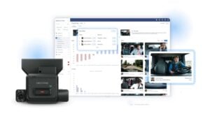 Geotab Announces New Safety and Video Solutions for Fleet Operations
-
 Geotab Connect 2027
Recent Stories for You



The Solutions Guide is a curated, original compilation by Modern Public Fleet. Individual lookups and linking are welcome; bulk extraction or republication is not. Guide terms.